New RIver Watershed- logging and water monitorinng, July 9th

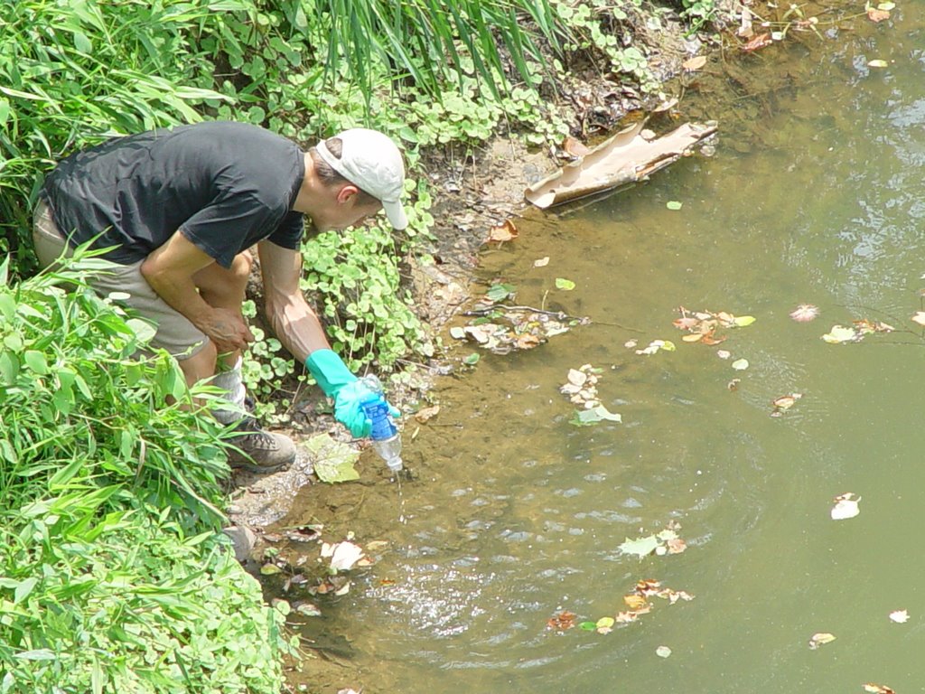
On July 9th, three scouts headed into the New River Water shed. Over the course of a day we took 17 water samples. From Knoxville we drove on 75 north until reaching exit 141. Exit 141 is route 63, and this route goes across the north side of the New River Watershed. Drive to the city limits of Fairview, and look for Norma rd on your left. The road is right before a gas station and strip mall. If you pass route 456 to Hunstville (on right), you have gone too far. As you turn onto Norma road notice that is gravel and small. This is a route that big coal and timber trucks drive down everyday, very fast, except Sundays, so if you decide to check these sites out yourself, please take caution and go on SUNDAY. Follow the windy road down, down, and further down. You will come to a bridge. In front of the bridge is a gravel road to the left with a stop sign. This was our first site Aa.
Date: July 9, 2006

Site: AA
Bottle: AA
Pictures: 3-5
Turbidity: 2.5
Speed: 1 (1-5; 1=pond, 5=flood)
Mileage: 101,308
GIS coordinates: N 36 deg 19.713
W084 deg 22.032
Altitude: 1140
Location:
On Norma Road, approx. 5 miles south of 63. Blue house and cornfield.
Appearance: Stream flowing under bridge. Water is cloudy
Animals:
Plants: mimosa, daisies, jewel weed, poison ivy, ferns, lots of weeds and grasses
Soil: dirty
Date: July 9, 2006
Site: AB
Bottle: AB
Pictures: 6-8
GIS coordinates: N 36 deg 17.616
W 084 deg 21.697
Location: On Norma Rd. approx. 9 miles south of 63. Road curves to right, stream passing under the road. One house on left hand side, address 9683
Appearance: water brownish, but fairly clear
Animals: water bugs, minnows
Plants: mimosa, wine berry, lots of vegetation
Soil: no bare soil on bank
Turbidity: 1.5 or 2
Speed: 3
Mileage: 101,313
Notes: near National Coal mining site #5

Date: July 9, 2006
Site: AC
Bottle: AC
Pictures: 9-13
GIS coordinates: N 36 deg 17.223
W 084 deg 22.010
Alttitude: 1129
Location: Smoky Creek Rd approx. ½ mile west of junction with Norma Rd. Parked at store on left hand side of road. Garden and single horse behind store near river. Robert Lowe bridge.
Appearance:
Animals:
Plants: Johnson grass, hay, jewel weed, ground cover in mint family
Soil: brown mud, clayish and slimy
Turbidity: 4
Speed: 1
Mileage: 101,314
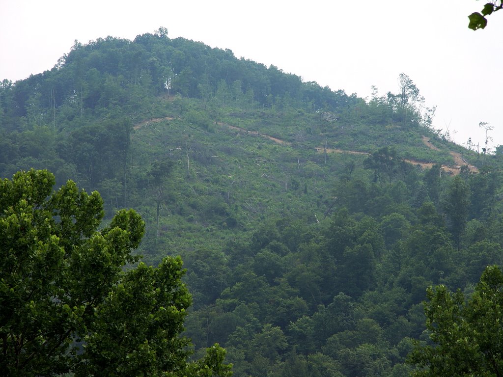
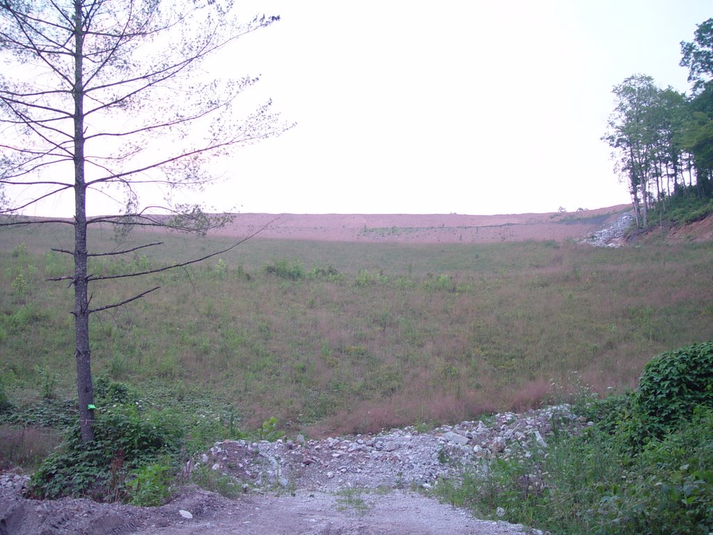
Clear cut # 1
Directions: 2 miles west on smoky creek road. The cut is visible on the left handside of the road.
Date: July 9, 2006
Site: AD
Bottle: AD
Pictures: 16, 17
GIS coordinates:N 36 deg 16.170
W 084 deg 23.566
Altitude: 1213
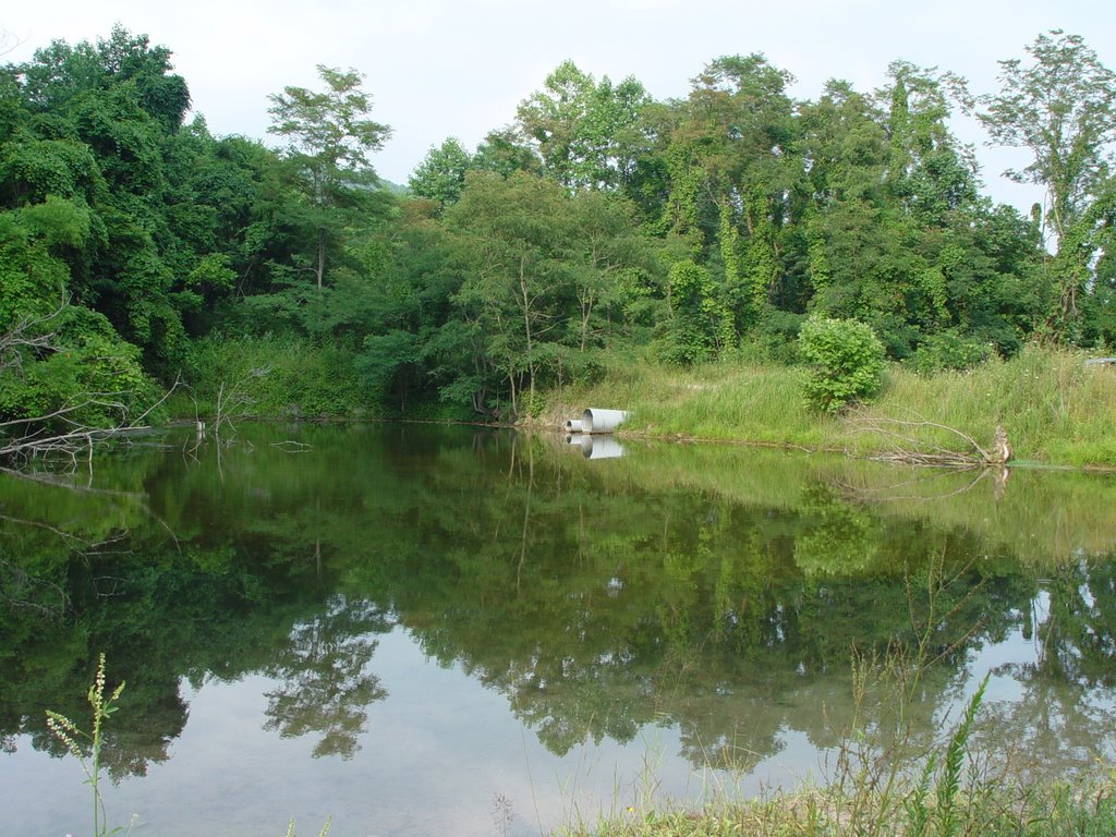
Location: apprx. 3.5 miles west on smoky creek rd. Two fairly rusty pipes carrying water under road
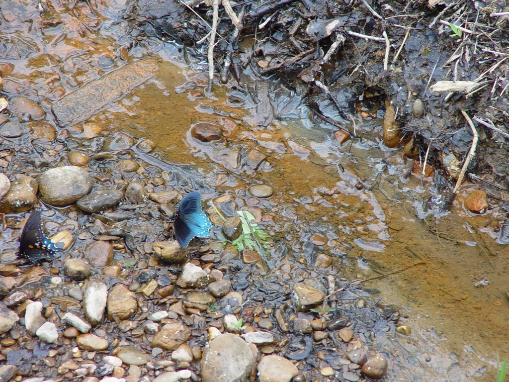
Appearance: stream is sedimented on bottom, but water is fairly clear. There is concrete in the water and rocks are slimy.
Animals: butterflies, minnows, waterbugs, black flies, dragon flies
Plants: queen anne’s lace, bull thistle, black berries, jewel weed
Soil:
Turbidity: 1
Speed: 1.5
Mileage: 101, 316
Notes: across from clear cut #1
Date: July 9, 2006
Site: AE
Bottle: AE
Pictures: 18-20
GIS coordinates: N 36 deg 15.274
W 084 deg 23.660'
Altitude: 1209 ft
 Location: Approx. 4miles down Smoky Creek Rd. Pulled over in Smoky Creek Baptist church parking lot on left hand side of road past the cemetery. River runs behind the church, approx. 75 miles down hill behind bathrooms/outhouses. River fairly inaccessible
 Appearance: water is sampled from wetlands before the river
Animals: deer tracks
Plants: water grasses, evergreen trees
Soil: wetland soggy
Turbidity: 5+
Speed: 0
Mileage: 101,317

Clearcut # 2, which is 4 to 5 miles from Smoky Junction on Smokey Creek Rd.
GPS coordinate (view from road): N 36 deg 15.274; W 084 deg 23.660
notes: In between sites AE and AF; closest to site AF.
 Date: ` July 9, 2006
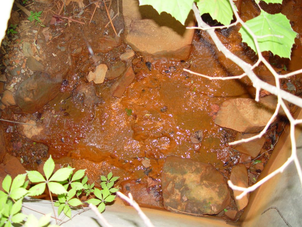
 Site: AF

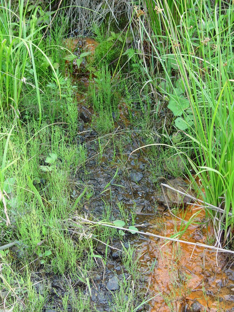
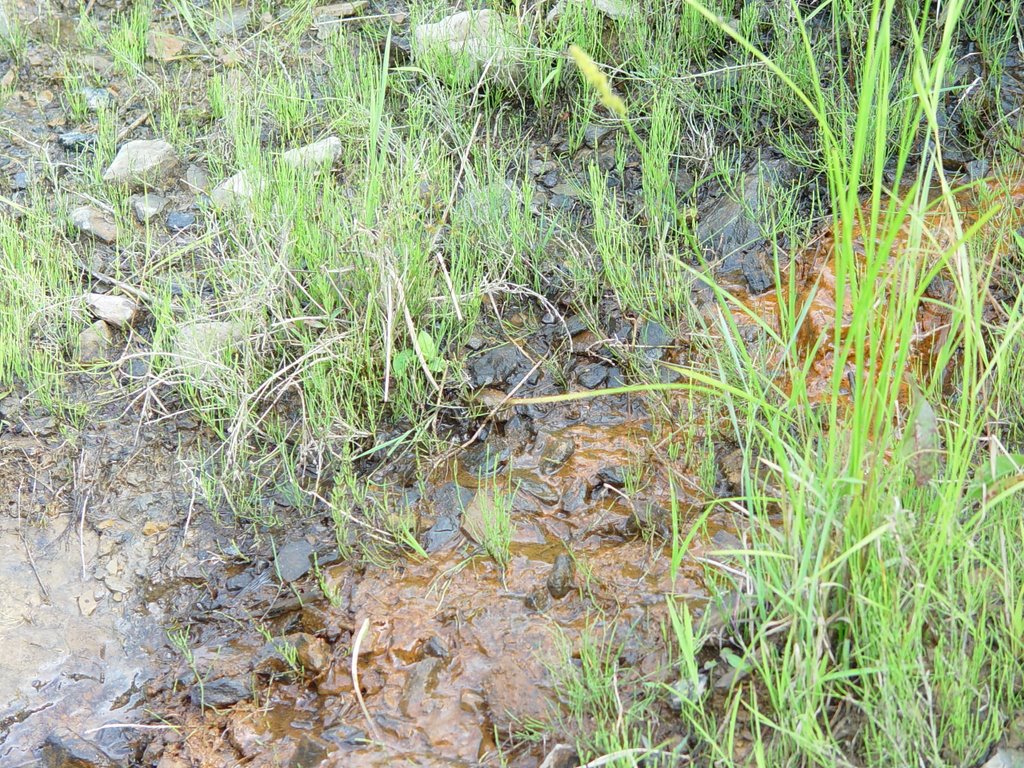
Bottle: AF1=water flowing above road
AF2=water flowing below road near orange gunk
Pictures: 28-34
GIS coordinates: N 36 deg 14.674
W 084 deg 24.625
Location: Approx. 5 miles down Smoky Creek Road. River flowing on left hand side of road. There is a gravel road crossing Smoky Creek Rd, and crosses the river to the left and continues up the mountain. Sample taken in reference to this gravel side road.
Appearance: there is some orange gunk along one side that is very congealed looking. Oil visible on top of water. Some algae is growing on rocks near bank opposite orange gunk. Water is murky and green, can see to depth of approx. 3 feet.


Animals: water bugs, many 2-3 inch fish, deer tracks, tadpoles
Plants: ferns, lichen, wild ginger, moss, black-eyed susans, queen anne’s lace
Soil: sandy mud
Turbidity: 3.5
Speed: 2
Mileage: 101,318
Notes: next to clear cut #2
Date: ` July 9, 2006
Site: AG
Bottle: AG
Pictures: 35-36
GIS coordinates: N 36 deg 13.740
W 084 deg 25.047
Alt 1437
Location: Approx. 7 miles down Smoky Creek Rd, approx. ¼ mile past Hembrey
Cemetery turn. Creek flows under the road. Guardrail on bridge has “smoky boys” spray painted on it.
Appearance: Creek is rocky and water is brown in color and is sedimented but clear. There are chunks of concrete in the water.
Animals: many silver fish approx. 4 inches long
Plants: tulip poplar, plantain, mimosa, queen anne’s lace, bull thistle, poison ivy, young oak trees, daisies
Soil: dry and sandy
Turbidity: 1
Speed: 2
Mileage: 101,320
Date: July 9, 2006
Site: AH
Bottle: AH
Pictures: 37-43
GIS coordinates: N 36 deg 12.191
W 084 deg 25.220
Alt 1541
Location: Smoky Creek Rd. approx. 2.5 miles past Hembrey Creek turn off. Pipes carry water under the road. A gravel road goes to right and up the mountain. Found clearcut 1/8 mile up this road. There is also a campsite between the water and the clearcut
Appearance: water is green-blue and there is orange gunk on surface. There are chunks of concrete in the water.
Animals: butterflies, many little bitty translucent fish
Plants: poke berries, black berries, queen anne’s lace, Colt’s foot, wild small daisies, red sumac, red stemmed grass bush, plantain, tulip poplar

Soil: soil is grayish and rocky
Turbidity:
Speed:
Mileage: 101,322
Notes: smell is musky and unpleasant right next to water
Mine Site Number #8 sign on the right hand side of the road.
GPS coordinates: N 36 deg 12.895; W 084.24877
Address: 7071 Smokey Creek Rd.; National Coal permit # TN0071803
Date: July 9, 2006 This water sample was collected near by the entrance to Mine Site #8
Site: AI
Bottle: AI
Pictures: see video
GIS coordinates: N 36 deg 12.195
W 084 deg 25.220
Alt 1541
Location: AH is a tributary to AI. The stream crosses the gravel road leading up the mountain. Campsite nearby w/ fire pit. Turn off the right hand side soon after sign saying “haul road #3, National Coal”.
Appearance: water is shallow. There is algae growing on rocks.
Animals: darter fish, ghost fish
Plants: Johnson grass, black-eyed susans, young oaks, colts foot, algae
Soil: squishy
Turbidity: 2
Speed: 1.5
Mileage: 101,323
Clearcut shots #4: headed up High point mountain, shot from the side of the road. By this time we had travelled 14 miles approximately from Smokey Junction.
GPS coordinates: N 36 deg 11.407; W 084 deg 24.999
Altitude: 2543 ft
Date: July 9, 2006
Site: AJ
Bottle: AJ
Pictures: 1-2 of card #2
GIS coordinates: N 36 deg 11.189
W 084. 24.674
Alt 2613
Location: On road headed up High Point Mountain (is it still Smoky Creek rd. here?) Entrance to National Coal mine site #9 is on the left hand side. Sample is from sediment pond at entrance to mine site.
Appearance: pea soupy, very murky, stagnant
Animals: frog, butterflies, ladybugs
Plants: bull thistle, queen annes lace, red stemmed grass bush
Soil: no visible soil
Turbidity: 5
Speed: 0
Mileage: 101,327
Note: slight chemical smell near water
NOTE in DIRECTIONS:
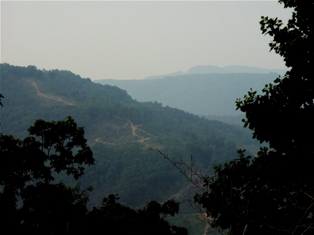
pictures: 3-6
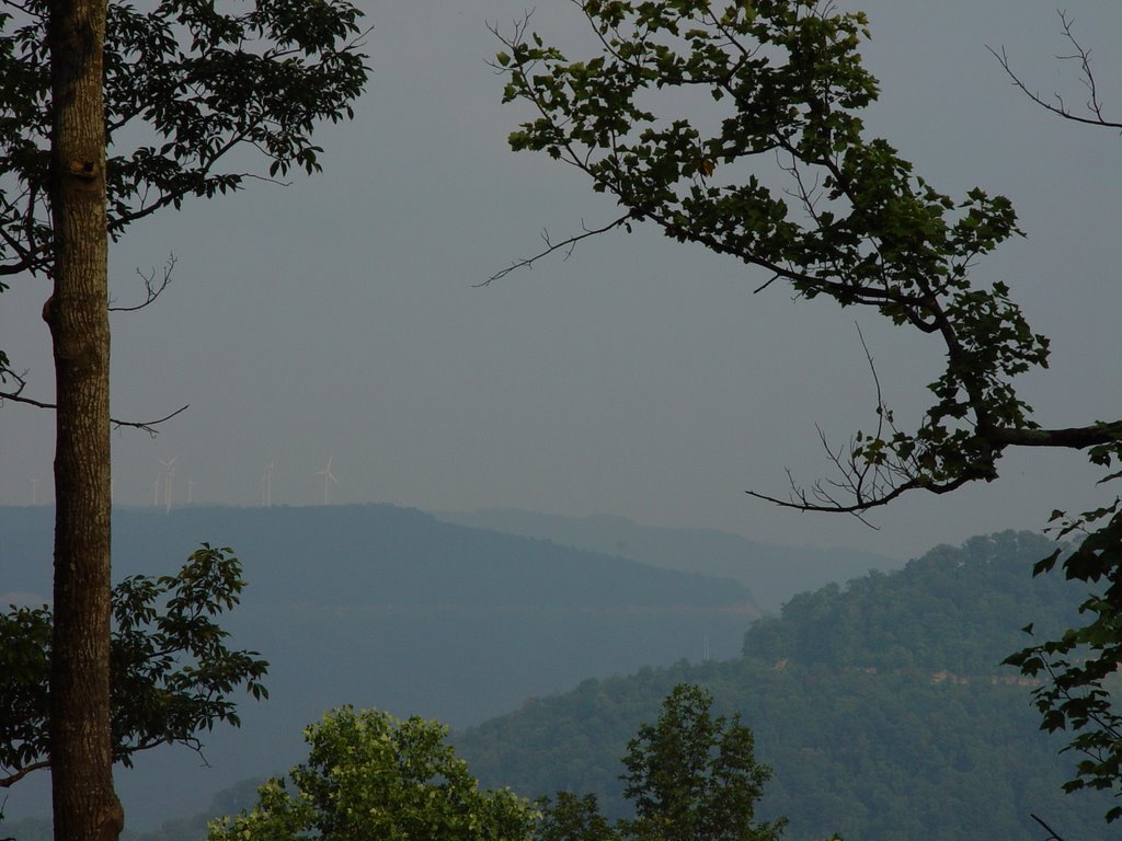
on top of high point mountain, you can see Buffalo mountain and surrounding strip mines. The Wind Turbines are a part of TVA's green switch program. The field work picture at the top of this page with wind turbines is from this site. This haze shows the air pollution that creates this haze from coal-fired mines and surrounding coal process plants.

Date: July 9, 2006
Site: AK
Bottle: AK1=creek
AK2= pond
Pictures: 8-21
GIS coordinates: N 36 deg 09.566
W 084 deg 26.225
Alt 2998
Location: ¼ mile past entrance to mine site #4 on the right side of the road. There is a small stream flowing into pond, and water is flowing under the road and flows down the mountain. There is a rock face behind the pond that is ranging from 60-85 feet tall and about 200 feet long. Power lines cross road above pond.
Appearance: water is bluish-blackish. There is a lot of algae on surface of water around edges of pond. There is a very thick green underwater plant in about 1/3 of the pond
Animals: butterflies, bull frogs, lots of fish: gray and black about 4 inches long
Plants: yellow bell flowers, plantain, tulip poplar, bull thistle, queen annes lacem black eyed-susans, kudzu growing on rock face
Soil: highly vegetated, no bare soil
Turbidity: 3.5
Speed: 5 at creek entering pond (sample AK1)
0.5 in pond
5 is sound of water as it exits under the road and flows down the mountain
Mileage: 101,331
Directional Note: Clearcut is visible after site AK, no photos are taken here, only video. N 36 deg 09.539; W 084 deg 25.001
Altitude: 2650 ft.
Location: Approximatley 28 miles from Smokey Junction on left side of the road.
Date: July 9, 2006
Site: AL
Bottle: AL
Pictures: 22-27
GIS coordinates: N 36 deg 09.611
W 084 deg 26.225
Alt 2650
Location: 1/8 mile past site AK, there is another pond on the right hand side of the road. There is a steep hill on far side of pond and bank of the road on near side is also steep. Small trickling streams coming down mountain on far side-streams are too low/slow to collect sample: really just scum trails
Appearance: stream flowing down mountain and into pond is really just some trickling orange gunk and there is a lot of algae growing on the rocks and look very slimy. The water of the pond is very brown and scummy on top, can also see oil on top of pond in some places.
Animals: many black and blue butterflies, deer tracks
Plants: yellow bell flowers, bull thistle, queen annes lace, crabgrass, poison hemlock
Soil: soil is mucky and slimy around pond, blackish, grayish and smells awful
Turbidity: 5, only visible for couple inches
Speed: totally stagnant water
Mileage: 101,331

Notes: very strong unpleasant, pungent smell of rotten grossness
DIRECTIONAL Note: Buffalo Mountain is visible again on the left
Photos: 28-30, however none of the pictures are clear,
Date: July 9, 2006
Site: AM
Bottle: AM
Pictures: 36-38, see video from 7/11/06 as well
GIS coordinates: N 36 deg 08.984
W 084 deg 23.179
Alt 1429
Location: intersection of Smoky creek/high point mountain mine road with New River rd./116 south. Directly across from coal processing plant and below mine site
Appearance: impossibly bright orange, Martian landscape, water rocks, dirt are all bright neon orange
Animals: none could possibly survive


Plants: lots of weeds are overgrown above the stream, blocking view from road
Soil: bright orange
Turbidity: bright orange
Speed: 2
Mileage: 101,336
Notes: unbelievably orange and smells like nasty chemicals and rotten bright orange rot
Date: July 9, 2006
Site: AN
Bottle: AN
Pictures: none b/c of rain
GIS coordinates: N 36 deg 12.681
W 084 deg 19.287
Alt 1404
Location: At intersection where 116 converges and divides in that weird triangle, where New River intersects with Ligias Fork. Bridge crosses river right at intersection. RR tracks running alongside river through intersection.
Appearance: River is wide, with fairly strong flow. Rocky, fairly clear water.
Animals: many ghostfish
Plants: mimosa, poison ivy,
Soil: sandy, pebbly
Turbidity: 2
Speed: 1.5-2
Mileage: 101,348 (minus I mile of backtrack)
Notes: moderate rainfall began approx. 5minutes before sample was taken
Date: July 9, 2006
Site: AO
Bottle: AO
Pictures: 41-43
GIS coordinates: N 36 deg 16.192
W 084 deg 20.853
Alt 1342

Location: traveling along gravel road back towards Smokey’s Junction from 116. We are pulled off on right hand side of road at the backside of a mine site. The stream is running down the hill, coming off mine site forming a pond. Another stream flows from opposite side of pond and is a tributary to the New River.
Appearance: Land around the pond is reclaimed, but top of hill on far side of pond where stream originates from may still be active. Water is moving quickly in and out of pond. Water is murky and stagnant, something slick on top of water.
Animals:
Plants: orange flowers, queen annes lace, ground ivy, water hemlock, kudzu
Soil: sandy, grayish, some red clay
Turbidity: 5, very murky
Speed: 3 speed of stream flowing into pond
4 speed moving out
0 pond itself
Mileage: 101,355
Clearcut siting # 5
Photos: 44-46; the pictures taken were too hazy...
Location: 1/4 mile from site AD. Visible directly ahead at the top of the ridges
GPS coordinates: N 36 deg 17.051
W084 deg 26.907
Altitude: 1338 ft
posted by petunia @ 2:13 PM
1 comments
![]()
